
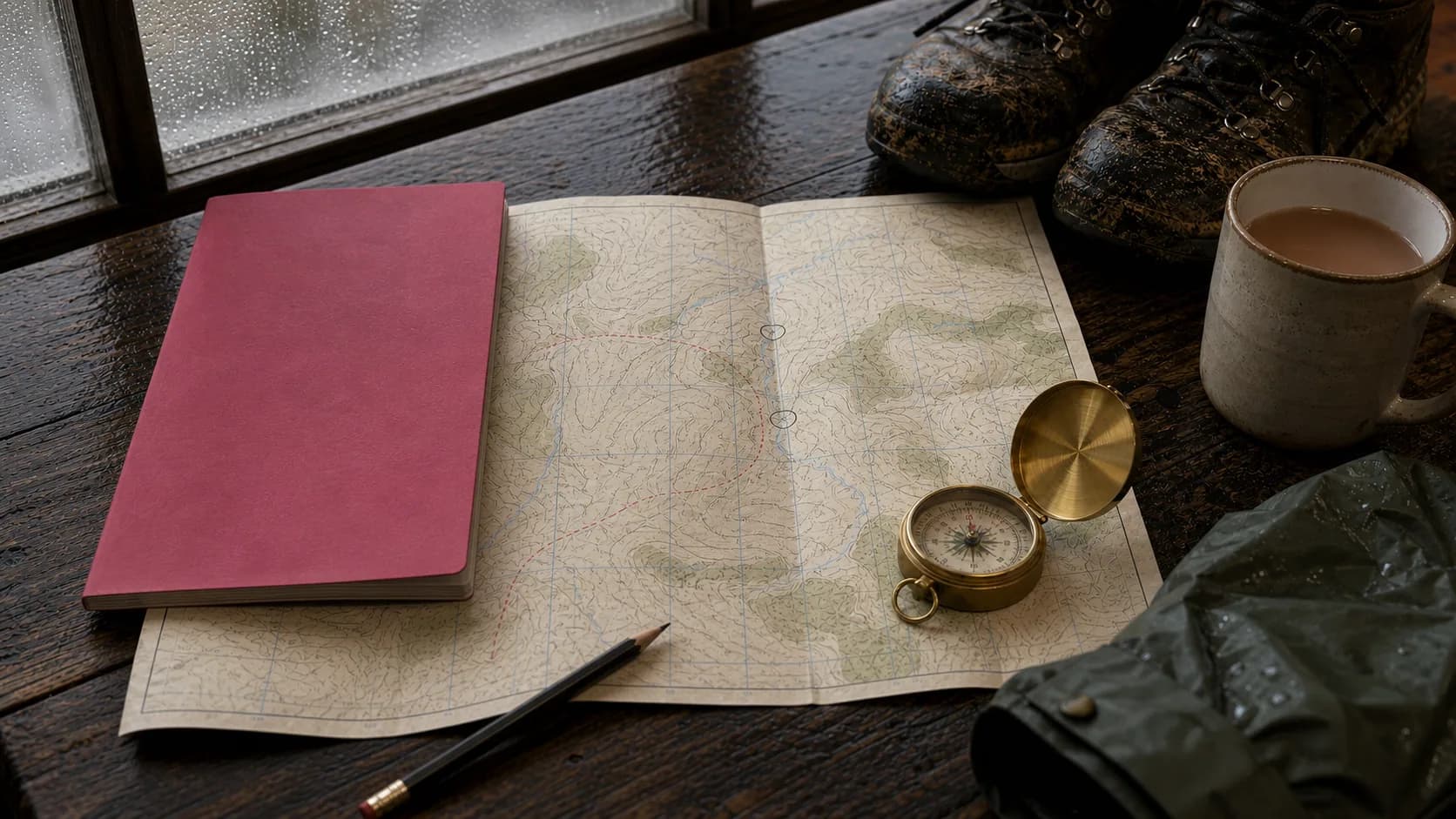
Why does Ordnance Survey matter so much to British map culture?
Ordnance Survey matters because it transformed the map from a state instrument into a shared British habit. OS traces its roots to military mapping of the Scottish Highlands after the 1745 rebellion and to later fears of French invasion; the official birth date is 21 June 1791.[2]
The first OS map available to the public was published in 1801 and covered Kent, a county considered vulnerable to French invasion. Once it entered public life, its appeal lay partly in giving ordinary people a detailed bird's-eye view of their own country.[3]
Today OS is still Britain's national mapping agency. It says it maintains a National Map with more than 600 million geospatial features, updated 20,000 times a day.[5]
The British map began as surveillance, became navigation, and ended up as memory.
How did a military survey become a walking ritual?
A military survey became a walking ritual because OS maps taught people to read ground as experience, not just information. The same features that once helped armies understand hills, roads and settlements later helped walkers understand gradients, routes, views, footpaths and access land.
Ordnance Survey's leisure-map identity grew especially strong in the 20th century. Its Landranger series developed from the one-inch mapping tradition, with the modern 1:50,000 series covering Great Britain in 204 maps.[4]
| OS map type | Scale | Best for | Why it matters culturally |
|---|---|---|---|
| Explorer | 1:25,000 | Walking, running, hiking and local detail | Shows footpaths, rights of way, open access land and vegetation in greater detail. |
| Landranger | 1:50,000 | Cycling, long walks, touring and driving holidays | Covers a wider area and has become the recognisable pink OS leisure map. |
| Custom or framed map | Varies | Gifts, memory and home decor | OS says personalised maps can centre on a chosen place or route and can be bought flat, folded, framed or as canvas. |
OS map type
Explorer
Scale
1:25,000
Best for
Walking, running, hiking and local detail
Why it matters culturally
Shows footpaths, rights of way, open access land and vegetation in greater detail.
OS map type
Landranger
Scale
1:50,000
Best for
Cycling, long walks, touring and driving holidays
Why it matters culturally
Covers a wider area and has become the recognisable pink OS leisure map.
OS map type
Custom or framed map
Scale
Varies
Best for
Gifts, memory and home decor
Why it matters culturally
OS says personalised maps can centre on a chosen place or route and can be bought flat, folded, framed or as canvas.
What makes the pink Landranger map culturally distinctive?
The pink Landranger map is culturally distinctive because it gives a whole day's landscape on one sheet. OS describes Landranger maps as ideal for long hikes, cycling tours and driving holidays, showing towns, villages, tourist attractions and transport links across a wider area than Explorer mapping.[4]
The Landranger's charm is partly practical and partly emotional. It is detailed enough to plan a route but broad enough to imagine a region. A Landranger map does not only answer "where am I?" It answers "what kind of country is this?"
That is why the Landranger sheet has become a British object in its own right. It belongs in rucksack pockets, glove compartments, kitchen drawers, muddy backpacks, holiday cottages and framed hallway displays.
Why do contour lines feel poetic to British walkers?
Contour lines feel poetic because they turn landform into rhythm. OS explains that contour lines help map readers understand gradients, valleys, steepness and terrain; the closer the lines, the more dramatic the slope.[6]
This is the quiet magic of an OS map: the hill appears before the hill. A walker can see effort before feeling it, imagine the descent before reaching it, and read a valley as a pattern of brown lines.
Grid references add discipline to the romance. OS explains that six-figure grid references narrow a position inside a grid square to a more precise location.[7]

Wide contour lines
Suggest gentler slope, wider pacing and easier walking.
Tight contour lines
Suggest steepness, effort and the dramatic pull of height.
What does the right to roam add to British map culture?
The right to roam gives British maps legal and emotional charge because maps show not only where land is, but where people may go. In England, GOV.UK defines open access land as land people can access without having to use paths, including mountains, moors, heaths, downs, registered common land and some land around the King Charles III England Coast Path.[8]
Walking culture is not a small niche. Sport England's latest Active Lives update says walking for leisure remains England's most popular activity, with around 22.9 million adults taking part.[9]
| Place | What access means | Why maps matter |
|---|---|---|
| England | Open access land can include mountains, moors, heaths, downs, common land and coastal access land. | The map shows where freedom is practical: paths, access land, coast, terrain and boundaries. |
| Wales | Natural Resources Wales says one fifth of Wales is mapped as access land with a public right of access on foot. | The map turns open country into a readable public landscape. |
| Scotland | Scottish Government guidance says Part 1 of the Land Reform (Scotland) Act 2003 sets out responsible non-motorised access to land and inland water with exceptions. | The map supports a wider culture of responsible access and outdoor confidence. |
| England and Wales rights of way | The House of Commons Library cites the Ramblers estimate of around 140,000 miles of public rights of way. | Footpaths turn the map into an invitation rather than a diagram. |
Place
England
What access means
Open access land can include mountains, moors, heaths, downs, common land and coastal access land.
Why maps matter
The map shows where freedom is practical: paths, access land, coast, terrain and boundaries.
Place
Wales
What access means
Natural Resources Wales says one fifth of Wales is mapped as access land with a public right of access on foot.
Why maps matter
The map turns open country into a readable public landscape.
Place
Scotland
What access means
Scottish Government guidance says Part 1 of the Land Reform (Scotland) Act 2003 sets out responsible non-motorised access to land and inland water with exceptions.
Why maps matter
The map supports a wider culture of responsible access and outdoor confidence.
Place
England and Wales rights of way
What access means
The House of Commons Library cites the Ramblers estimate of around 140,000 miles of public rights of way.
Why maps matter
Footpaths turn the map into an invitation rather than a diagram.
What does critical cartography reveal about the OS map?
Critical cartography reveals that maps are never neutral pictures of land; they also express power, ownership, law and social order. The cartographic historian J. B. Harley argued that even scientific maps are shaped by social rules and values, and that maps can work as instruments of authority as well as measurement.[13]
That critique matters for Ordnance Survey because OS began as a military survey. The map's authority came from measurement, but also from the state's desire to know land more completely than anyone else.

Map as power
Military survey, property, law, boundaries, administration and state knowledge.
Map as belonging
Walking, memory, gifts, home, routes, childhood places and framed attachment.
Why do Britons frame maps?
Britons frame maps because a map can act as evidence of belonging. A framed map can mark a childhood town, a first home, a favourite walk, a university city, a holiday route, a proposal spot, a family migration or a place someone still misses.
OS itself has leaned into this emotional use of maps. Its Custom Made map history says sales rose by 144% during the 2020 lockdown compared with the year before.[14]
For Zellart, this is the natural bridge between British walking culture and home decor. A map wall art collection should not be presented only as travel decor. In a British context, map wall art also belongs to the culture of footpaths, memory, local pride and place attachment.

What kind of map print suits each British room?
The best map print depends on whether the room needs memory, detail, drama or softness. Zellart's indexed map collection includes world maps, push pin maps, vintage maps, watercolour maps, landmark maps and colourful cartography for offices, studies, living rooms, classrooms, entryways and children's rooms.
| Room | Best map style | Why it works | Zellart slot |
|---|---|---|---|
| Hallway or entryway | UK or local map print | It makes arrival feel personal and rooted. | Wandsworth London UK Map or another local map product. |
| Home office or study | Detailed world map | It rewards close reading and suits desks, bookshelves and planning spaces. | World Map No. 1498 or detailed world map wall art. |
| Living room | Black-and-gold or vintage world map | It reads as a statement piece rather than a classroom map. | Black / Gold World Map or Vintage World Map. |
| Family travel wall | Push pin world map | It turns the print into a record of places visited and places still planned. | Push Pin World Map No. 807. |
| Child room or classroom | Watercolour or colourful world map | It adds geography without making the room feel formal. | Watercolor world map wall art. |
| Travel-lover gallery wall | Landmark world map | It connects countries with recognisable buildings and memories. | World Map with Landmarks No. 101. |
Room
Hallway or entryway
Best map style
UK or local map print
Why it works
It makes arrival feel personal and rooted.
Zellart slot
Wandsworth London UK Map or another local map product.
Room
Home office or study
Best map style
Detailed world map
Why it works
It rewards close reading and suits desks, bookshelves and planning spaces.
Zellart slot
World Map No. 1498 or detailed world map wall art.
Room
Living room
Best map style
Black-and-gold or vintage world map
Why it works
It reads as a statement piece rather than a classroom map.
Zellart slot
Black / Gold World Map or Vintage World Map.
Room
Family travel wall
Best map style
Push pin world map
Why it works
It turns the print into a record of places visited and places still planned.
Zellart slot
Push Pin World Map No. 807.
Room
Child room or classroom
Best map style
Watercolour or colourful world map
Why it works
It adds geography without making the room feel formal.
Zellart slot
Watercolor world map wall art.
Room
Travel-lover gallery wall
Best map style
Landmark world map
Why it works
It connects countries with recognisable buildings and memories.
Zellart slot
World Map with Landmarks No. 101.
Map wall art edit
Map prints for people who read maps, not just directions
These cards use live Shopify thumbnails, current prices and availability. The edit moves from local UK memory to detailed world maps, push pin travel records and statement cartography.

Local memory
Wandsworth. London, UK map №1573 Ready to Hang Canvas Print
£60.82
Available now
Best for: Local pride, London homes and housewarming gifts
View map print
Study wall
World Map №1498 Ready to Hang Canvas Print
£60.82
Available now
Best for: Detailed office maps, study walls and planning spaces
View map print
Travel record
Push Pin World Map №807 Ready to Hang Canvas Print
£79.78
Available now
Best for: Family travel walls, memory walls and interactive decor
View map print
Vintage warmth
Vintage World Map №710 Ready to Hang Canvas Print
£79.78
Available now
Best for: Libraries, warm neutral rooms and classic study interiors
View map print
Graphic statement
Black / Gold World Map №860 Ready to Hang Canvas Print
£79.78
Available now
Best for: Modern living rooms, dramatic offices and luxury neutral decor
View map print
Landmark story
World Map with landmarks №101 Ready to Hang Canvas Print
£60.82
Available now
Best for: Travel lovers, family spaces and conversation-led wall art
View map printHow do you style map wall art without making it look like a classroom?
Map wall art stops looking like a classroom when it is styled as memory, not instruction. Choose a scale large enough to read as an artwork, place it with warm materials, and avoid surrounding it with too many small travel cliches.
Hang a large map print where people naturally pause: hallway console, desk wall, reading corner or dining-room sideboard.
Pair vintage maps with walnut, brass, leather, linen and warm lamplight.
Pair blue or monochrome world maps with black frames, pale walls and clean-lined furniture.
Use one large map rather than many small map fragments if the room is compact.
Add one supporting artwork only: a landscape, cityscape or coastal print that connects emotionally to the mapped place.
Takeaway
What is the final answer?
The British romance of the map comes from a contradiction: Ordnance Survey began as a way for the state to measure and control land, but it became one of the ways people love land. For Britons raised on OS maps, a framed map does not say "I like geography." It says "I know where I belong."
FAQ
Ordnance Survey, walking culture and map wall art
Was Ordnance Survey originally military?+
Yes. Ordnance Survey traces its origins to military mapping after the 1745 rebellion and later fears of French invasion. OS recognises 21 June 1791 as its official birth date, when national triangulation and military survey work became the foundation of Britain's mapping agency.
What was the first Ordnance Survey map?+
The first Ordnance Survey map published for the public was the 1801 map of Kent. OS explains that Kent was strategically important because it was vulnerable to French invasion, but the map quickly appealed beyond military use because it gave people a detailed bird's-eye view of place.
What is an OS Landranger map?+
An OS Landranger map is the pink 1:50,000 Ordnance Survey leisure map used for longer routes, cycling, touring and general outdoor navigation. OS says Landranger maps show roads, tourist features, footpaths and rights of way, with 204 sheets covering all of Great Britain.
What is the difference between Landranger and Explorer maps?+
Explorer maps are 1:25,000 scale and show more local walking detail, including footpaths, rights of way, open access land and vegetation. Landranger maps are 1:50,000 scale, cover a wider area, and are better for cycling, touring, driving holidays and longer routes.
What does "right to roam" mean?+
In England, the right to roam means public access to certain land without having to stay on paths, including mountains, moors, heaths, downs, registered common land and parts of the coastal margin. Scotland has broader responsible access rights under the Land Reform (Scotland) Act 2003.
Why are maps popular as framed gifts?+
Maps are popular as framed gifts because they turn a location into a memory object. OS says its Custom Made maps can centre on a chosen postcode, village or route, and its personalised map sales rose by 144% during the 2020 lockdown compared with the previous year.
Are map prints good wall art?+
Map prints are good wall art when the map has personal or visual meaning. A detailed world map suits a study, a vintage map suits a library or warm living room, a push pin map suits family travel memories, and a local UK map suits a hallway or housewarming gift.
Author note
Written by Zellart Editorial Team
Zellart writes about wall art, interiors, art history and visual culture for UK homes and commercial spaces.
Zellart editorial
Read more
Three related Zellart essays to keep the thread going.

Art & Design
The Beige International
How Airbnb, staging and ecommerce taught rooms to look the same, and why walls still need to argue for someone.
Read article
Interior Design
What Hotel Lobbies Know About Art
What hotel lobbies understand about scale, mood, local reference and first impressions.
Read article
Art & Design
The Nine-Foot Problem
Horses, coffeehouses, gaslight, hemp canvas and city predictions that never quite arrive.
Read article